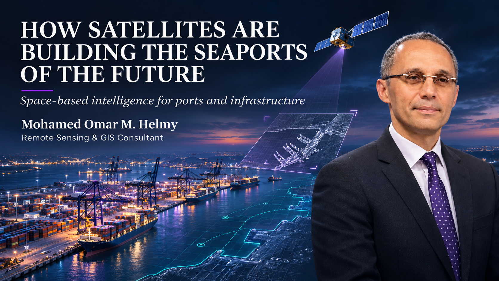
The food we eat, the fuel we use and many of the products in our homes have travelled through a seaport. So how do governments decide where to build one, how to expand it and how to protect it? Mohamed Helmy answers those questions from orbit. He is a remote sensing and GIS consultant specialising in geospatial solutions, SAR imagery, AI-driven satellite analytics, climate change, ports and national infrastructure programmes.
I'm Arn Terry, host of The Space Curious Podcast and founder of Daniel Ernest / DE Orbit, the space recruitment specialists. When Mohamed joined me on the show, we talked about how a view from space shapes decisions made at sea level, and what it takes to build a career in this field. Here's what I took from the conversation. His quotes are lightly edited for readability.
Where did Mohamed Helmy's journey in remote sensing begin?
Like many people in this industry, it started with films. "I was a big fan of space movies and NASA missions like landing on the Moon," Mohamed told me. He qualified as a computer engineer in 1995, then took a diploma in space dynamics at Cairo University's Faculty of Science around 2000, studying orbits and the perturbations satellites face.
The project that changed his view of what satellites could do was national in scale. Egypt's government wanted to count the winter wheat growing across the whole Nile Delta. His team used imagery and AI to separate wheat from every other crop, estimate the area in feddans and forecast the yield for citizens. Food security, worked out from space.
That is the heart of his work. "It's far from just computer processing," he said. "It's a vision of how to solve business demands."
What is remote sensing, and how is it different from GIS?
Mohamed keeps the definitions simple. Remote sensing means reading, measuring and capturing information about the surface "from far from the ground… not in direct contact with the Earth". That could mean testing minerals, mapping vegetation or assessing the environment.
GIS is the next step. "It is a mapping technology, making digital maps and statistics, so you can summarise the results and tell the decision-makers what's happening there." One gathers the evidence. The other makes it usable.
What is SAR, and why does it matter for ports and coastlines?
Synthetic aperture radar is Mohamed's speciality. "It's the technique for the satellite to replace the camera with a microwave antenna," he explained. The satellite sends waves and collects them again to read the surface.
Because it works in the X, C and L microwave bands, SAR penetrates cloud and doesn't rely on the Sun. "This is the power of SAR. It gives you information day and night, at any time, in any climate conditions." For coastlines that face storms and cloud cover, that means continuous monitoring rather than gaps in the record.
Why are seaports such a unique business?
Most organisations push forward against competitors. Ports have to do that while managing resistance at home. "You are facing two sides," Mohamed said. One side chases trade and economic value. The other is "internal resistance from the government, from the citizens, from environmental experts".
He sees governments investing in three pillars:
The third pillar is the one that often gets overlooked. Infrastructure and vessels can be bought. Capability has to be built.
How do satellites help plan and expand a seaport?
You can't simply walk into a port and survey it; you need security clearance. Satellite imagery gets round that. It shows how many terminals a port has, whether container, dry bulk or liquefied natural gas, and so how technically advanced it is.
Time series take it further. "Time series means going back through historical events to check the expansion of the port, the transformation of the port, how it was, and nowadays as a modernised one." Analysts can count container yards, warehouses and logistics areas, and see which direction the port is growing.
Expansion is political as well as technical. "Ports are the waterfront of the city," Mohamed said. Expand the port and you shrink the waterfront. That's why the governor, police, roads and land administration and local businesses all need to be "on the same table" before the port can grow without resistance.
Can space technology stop a port being built in the wrong place?
It can inform that decision before billions are committed. Planners use time series alongside studies of coastal erosion, tidal effects and natural habitats.
The engineering is enormous. Mega vessels carrying 24,000 to 25,000 containers need a draft of around minus 18 metres, so ports dredge their basins. The sand removed is often used for land reclamation to build new yards. Both affect habitats, which is why Mohamed insists the environmental picture comes before the expansion plan.
What makes a port "smart"?
Smart ports are the next generation. Vessels waiting to enter are tracked by AIS, the automatic identification system, connected to AI and cloud processing. The system identifies each vessel type, whether tanker, container ship or general cargo, so the port authority knows early what's approaching and can plan berths and logistics.
Near-real-time monitoring is closer than many people think. Mohamed described it as a fusion: optical and radar imagery from remote sensing satellites, position updates from communications satellites, and AIS. "It gives very sharp and updated real-time information for the port authority."
How are satellites helping ports adapt to climate change?
Mohamed always links environmental impact with social impact. Automating a container yard can mean workers losing their jobs. "There is a very big need for adaptation and balancing between modernisation and social and environmental issues."
The environmental risks are familiar to anyone who lives near a port: water pollution from engine washing and vessel waste, oil spills, and noise from on-dock railways moving containers day and night.
Then there is flooding. Ports worldwide have faced mega floods they weren't ready for. Breakwaters and tidal defences help, and satellites carrying optical, thermal and atmospheric sensors can support rainfall and flood forecasting decades ahead. When I asked which climate threat decision-makers are underestimating, his answer was immediate: "Really, the floods. The level of water is rising."
Do developing countries need their own satellites?
No, in Mohamed's view. "Space is for all," he said. Some countries run full national programmes with satellites, ground segments and launchers. Others rely on commercial data and still make good decisions on the ground.
Speed is the deciding factor. A government programme can take five to ten years to get approval, strategy and funding for two or three large satellites. A commercial operator might have 40 or 50 in orbit within three or four years. "In a business way, you are usually looking for availability," he said. More satellites means more revisits, which means more of the economy can be served.
The economic case is concrete. Satellite imagery feeds suitability models that choose the best sites for logistics hubs and warehouses, which in turn attract investors to fund them.
What skills do you need to work in space-enabled port projects?
Mohamed coaches new graduates, and he describes two tracks. One is the maritime industry itself: shipping, infrastructure, automation, equipment and port performance. The other is the IT arm: "the digital transformation of the ports".
For the digital track, his list is clear:
His advice on qualifications is practical. Certified online courses are available to everyone. But first, "you need to decide what's your roadmap, what's your career and what's your next step".
At DE Orbit, the space division of Daniel Ernest, we see the same overlap Mohamed describes. The hardest people to find in Earth observation sit between two worlds: they understand the satellite data and the industry it serves. A geospatial analyst who knows how a port authority makes decisions is worth far more than one who only knows the software.
What's the biggest myth about satellite imagery?
Films have a lot to answer for. "Satellite imagery cannot see under the roof," Mohamed said. "If you are hidden in your room, the satellite would not see you. It needs open space to see."
Space Curious quick-fire round
What should a port built today still show in 50 years?
I asked Mohamed to imagine a port designed with his work still serving trade 50 years from now. What should it demonstrate about today's decisions? "The port needs to stay connected with society and the community, to know the needs of the citizens for a better life."
His closing words were just as humble. "I'm still learning. And we will continue learning until our last moment."
Are you hiring?
If you're building a space team and need engineers, operators or leaders who have done it before, I'd like to hear about it. Email me at arn.terry@danielernest.com or connect with me on LinkedIn.
About The Space Curious Podcast
The Space Curious Podcast is hosted by Arn Terry and powered by DE Orbit, the space recruitment division of Daniel Ernest. Each episode talks to the founders, engineers and leaders building the space economy. Watch the full conversation with Mohamed Helmy on The Space Curious Podcast.
Daniel Ernest / DE Orbit helps space companies build mission-critical teams, from Earth observation and geospatial AI to ground segment, mission operations and spacecraft engineering. To find out more, visit Daniel Ernest / DE Orbit.